
UAE record rainfall in 2024: warm seas linked to the historic storm
Unusually warm seas helped drive the record rains that hit the United Arab Emirates on April 16, 2024. A team at NYU Abu Dhabi shows that higher sea surface temperatures loaded the air with moisture and shaped where the storm delivered it. Their analysis connects ocean conditions to a rare and damaging extreme over the country.
What the researchers found
The team at the Mubadala Arabian Center for Climate and Environmental Sciences (ACCESS) combined satellite data with computer simulations. Sea surface temperature (SST) is the temperature of the ocean’s top layer. Warmer SST increased atmospheric moisture. That extra fuel strengthened convection, the rapid rise of warm, wet air that builds deep storm clouds. As a result, heavier rain formed over the UAE. With cooler seas, much of the moisture would have fallen farther north, over Iran’s Zagros Mountains.
Lead author Basit Khan and co-authors Subrota Halder, Zouhair Lachkar, Francesco Paparella, and Olivier Pauluis argue that tracking SST anomalies can improve short-range forecasts in the region. Their work aligns with independent operational assessments of the same event.
UAE record rainfall 2024: the key numbers
On April 16, the country saw its heaviest daily rainfall in modern records. The National Centre of Meteorology (NCM) reported 254 mm in the Khatm Al Shakla area of Al Ain within 24 hours. Dubai measured about 142–144 mm, close to or above a typical year’s total in parts of the city.
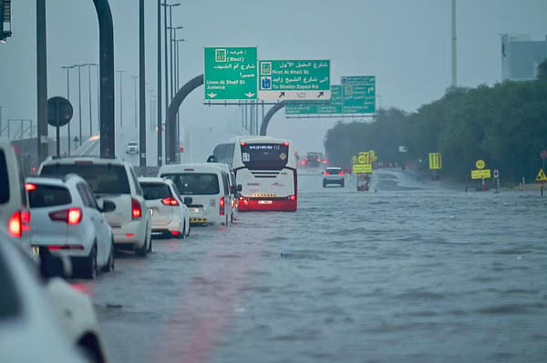
The downpour flooded roads and neighborhoods and disrupted operations at Dubai International Airport over several days. Airlines canceled and diverted flights as crews cleared standing water and managed stranded passengers.
Why the warm ocean mattered
Two mechanisms stood out. First, warmer waters in the Arabian Sea and nearby gulfs added moisture to the lower atmosphere. Second, this moisture intensified convective storms as the system crossed the region. According to the study, SST anomalies also helped steer the heaviest bands toward the UAE instead of areas to the north. This ocean–atmosphere coupling explains both the scale and the placement of the rainfall.
What changes for forecasting and planning
The findings support routine use of coupled ocean–atmosphere inputs in regional forecasting. Integrating real-time SST fields can sharpen risk maps, improve lead time, and guide targeted warnings. Authorities can then plan drainage, traffic management, and airport contingencies with better precision. Dubai has already announced major investments to expand storm-water capacity after April 2024’s floods, signaling a strategic shift toward climate resilience.
Building better models for a drier region facing wetter extremes
The ACCESS team’s results strengthen evidence that local ocean variability can amplify extremes over the Arabian Peninsula. In practice, this means city planners, insurers, and operators should expect rare but intense bursts of rain, even in an arid climate. Better coupling of ocean signals with high-resolution weather models can turn that insight into actionable preparedness across the UAE.
In sum, the April 16, 2024 event was historic in scale and impact. By tying it to unusually warm seas, the new research offers a clear path to better forecasts and more resilient infrastructure in the years ahead.